Mountains that make a small country great
Information
Level
High
Distance
22.00 km
Drop
800 m
Duration
7 h
Tracks
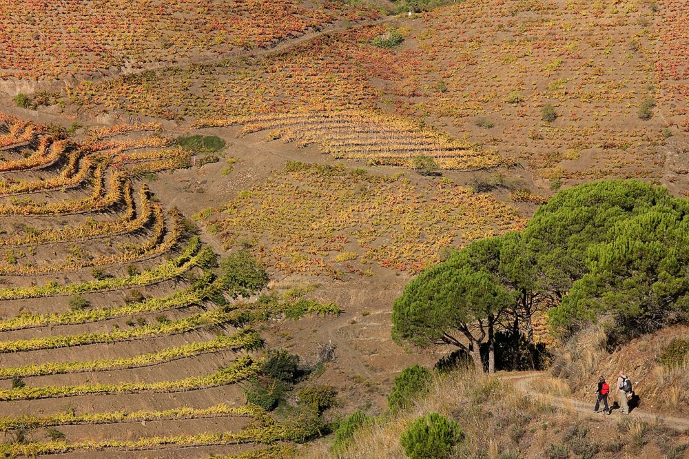
From Porrera to Torroja, to Poboleda and back by the Coll dels Tossals. Demanding route with a lot of up and down among DOQ Priorat vineyards.
Porrera - Torroja
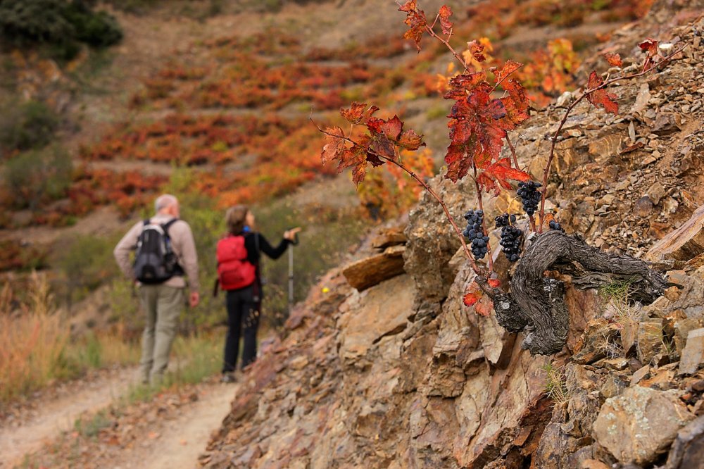
Leave Porrera at the top of the village, along the Carrer de l'Encastell, on the path known as the Camí dels Trossets. Pass beside the village water tank and the old cemetery, now converted into a viewpoint over the village. The well-trodden old mule track follows the ridge, on some of the most ancient slate soils in the Priorat, dating from the Devonian era. There are broad, spectacular views. The mule track joins a cart track at the Collet de Comaenromeu (a collet is a small pass). Carry on to the right, on the sunny side, descending slightly to a junction. Go straight ahead, on the level along the track crossing the Partida de Terracoques on the side of the hill. You come to a cemented bend in the track and carry on uphill towards the Mas de la Rosa (mas means farmhouse). You are surrounded by spectacular hillsides.
When you come to the Collet del Mas de la Rosa, cross it and head downhill. On one of the first bends in the path, hidden among the hazelnut trees, is the Font de Muntaner (font means spring). You then come to a fork. Take the top path, crossing the hillside vineyards of Vall Llach.
You come to the Collet del Mas de la Plana del Seba. Carry on going slightly uphill and you soon pass beneath the farm, which used to be one of the biggest in the area, with as many as seven vats, inhabited until the 1960s. Follow the path beneath the farm across the flat ground and then you come to the Coma Vidala (a coma is a coombe or depression). The path then climbs up to the pass separating the Coma from the land of the Mas d'en Gregori. After the pass, the path goes gently downhill, into replanted pine woods. When you come to a fork take the right-hand path and leave the track going down to the farm. The forest track runs level to the next small pass, where you come to a large, newly-planted vineyard.
Follow the main estate track downhill until you are almost beside the large irrigation tank. Here you leave the main path and take another one to the right that climbs steeply to the Collet del Pinell (shame the old abandoned digger has never been taken away). Just after passing a chain across the path, take the old Pinells path off to the left, leading to Torroja. This path has recently been restored. The old path meets a farm track and carries on downhill towards the village. Just before you get there, turn right off the track onto a final section of the old mule track, which joins the road just above a spring.
Torroja - Poboleda
The old path to Poboleda starts out beside the cemetery. Go past the water treatment plant and go down to the stream bed, following a track that is cemented at first. When you come to the stream bed, carry on along the path going up beside the watercourse, which is usually dry. After a short while, you come to a first, very pretty bend in the mule track which still has much of its old stone paving. Higher up, on the other hand, it is badly eroded. The force of the water, decades of neglect and irresponsible use by motorcycles has completely destroyed much of the stone paving and the structure of the old route between Torroja and Poboleda.
On this first section the path climbs beside very old olive groves and hillside vineyards. Higher up it has been turned into a wider farm path, which you follow until it joins the track. Here you take the old path - also badly eroded - which goes straight up to the last part of the Barranc de Poboleda (a barranc is a seasonal watercourse), where the farmland and houses have been abandoned. The final stretch of the old path has unfortunately been almost completely destroyed by a track that is now abandoned. When you come to the Coll de Poboleda, go downhill to the left along the track. You pass some recently-planted vineyards and lower down find some sections of the old stone paving of the mule track.
When you come to more level ground you go along a charming old cart track which takes you between fields, poplars and reeds to the river Siurana. You do not have to ford the river. Shortly before you get to it, to the right of the track is a path along a water channel, which you should follow. This leads to the old narrow footbridge by the mill, which still has the old chains securing the logs to the rock, on one side only so that when the river is in spate the force of the water will not carry the bridge away downstream.
Cross the footbridge and carry on to the right, following the path by the river, which passes beside the old monks' mill. A little further along on the left is the path leading up into the village.
Poboleda - Porrera
To get to the path to Poboleda over the Coll dels Tossals (a coll is a pass), the most direct and probably the oldest route, you can choose one of two ways out of Poboleda. the most direct means fording the Siurana (and probably getting your feet wet). Turn left at the church down the Carrer Nou. On the other side of the river you join the path that leads into the valley.
The more convenient route is a slightly longer way round. Set out to the right of the church, also on the Carrer Nou. When you come to the path along the riverbank, follow it to the left. Cross the river over a cement bridge and very soon the track turns to go up the valley.
The route is easy to follow, leading first to the vineyards of the Mas Sinén, home to the Burgos Porta winery, about halfway up the valley. These wine-growers' care of their vineyards has created a beautiful landscape that is certainly reflected in the wines they make.
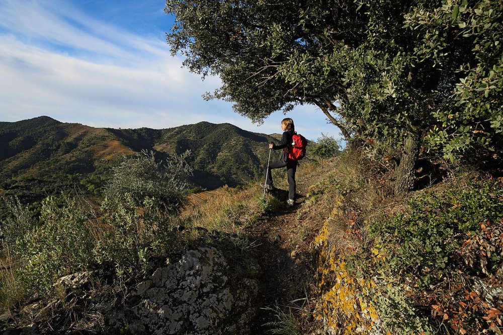
The path passes just above the winery and carries on up the valley. Higher up there are no more vineyards, though the marges (retaining walls holding up field terraces) show that practically the whole mountain was cultivated at one time. Follow the path, which gradually becomes narrower and prettier Cross a small embankment to join the old mule track leading into a young holm oak wood towards the pass, which is very close and covered in trees.
The path starts to descend on the other side, turning left and running along the side of the shoulder of El Tossal. Go gently downhill as the horizons open up and pass some fine specimens of holm oaks. Old drystone walls - many of them unfortunately in very bad condition - help to support the path on the steep hillside. After a small descent, the path runs around a shoulder and joins a ridge, where it carries on downhill. Further along the path leaves the ridge, turning left to go down the hillside (which used to be farmed), losing height in wide zig-zags. You come to another shoulder, which the path wisely follows down almost to the bottom of the valley. You come out onto a farm track, which you follow for a little while. When you come to a crossroads, turn off the wide track onto the old path to the left, a little above it. Further ahead cross the same path and carry on downhill. Pass close to the road to the Coll de Marrades, but do not cross it until lower down.
Here the old path is cut by the road and partly buried by its embankment. You should therefore go along the private path leading into a magnificent hillside vineyard with old vines. Needless to say, you should be especially careful not to harm the vines. Lower down, rejoin the old path to go down a rocky shoulder until, at the bottom of the valley, you join the old path to Cornudella which went up via the Coll de les Marrades, which was also the most commonly used path to go from Porrera to Poboleda on horseback.
Follow the cart track to the right, downhill. Pass under the Marco Abella winery and then onto the road. Follow this for a few metres and very soon you come to a fork. The right-hand path takes you straight to the top of Porrera, to the Encastell neighbourhood. If you are heading for the Plaça Catalunya it is better to follow the road to the next way into Porrera.
Image gallery