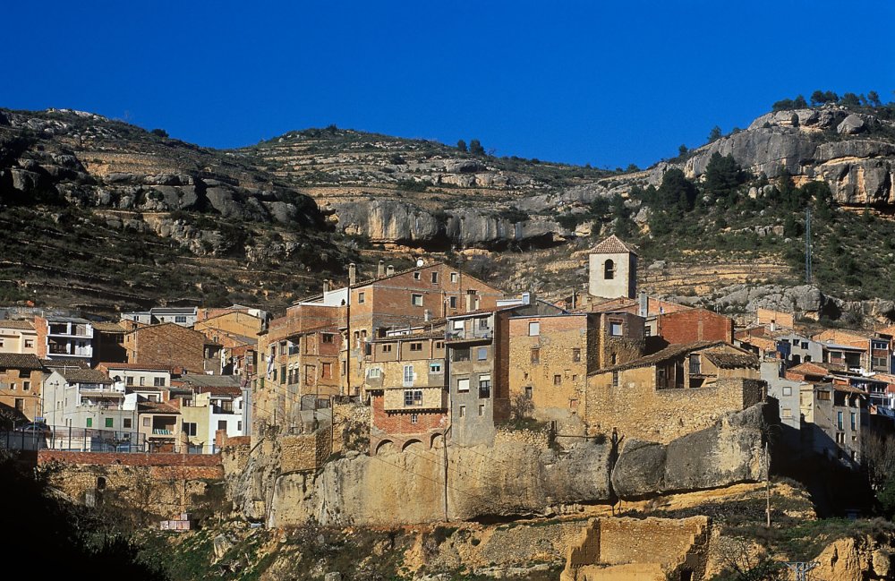
Itinerary 8 Montsant: La Bisbal de Falset
Information
Level
Low
Distance
9.20 km
Drop
350 m
Duration
4 h
A trail through the western gullies of the Serra de Montsant, those that have been most shaped by human activity in the not too distant past. Recommended for those who want to enjoy historical and cultural heritage within a beautiful natural area.
On the way up, we follow the old path that joined La Bisbal de Falset and Cabacés. In many places this is now a track. An extra circuit at the top means we can see higher landscapes, and get closer to the topmost part of Montsant. The descent will take you through the Barranc (gully) dels Colls Baixos and offers a new chance to see how human activity and nature can mingle in some exceptional natural areas.
This is a long trail that is suitable for all types of walker. At the beginning and end there are wooden signposts placed there by Turisme de Catalunya, the Tourist Board of Catalonia. It is a walk that can be done at any time of year, but it is unadvisable at very sunny times of year, as it runs through fields of crops, some of which are abandoned. Remember to bring water .
LEVEL OF DIFFICULTY: LOW
Trail description
The walk leaves from beside the swimming pool, where there is a recreation area and a car park. Cross the river by the bridge and you will see an old stone path that climbs directly up from there. Take this path and continue in the same direction on the track, which leads through fields of crops. The signpost indicates Montsant via the Coll de Manxa. The path is easy to follow if at the various forks you do not turn off towards the fields or the forest. The path is made easier to follow by the marks in white paint that show the way. So, at the first fork, continue to the right, then left at the next two. When the track turns sharply, ignore the path that runs off to the right. You will come to a stone hut, and beside it is a small tank that collects the rainwater that runs off the roof. Continue along the path that runs through the forest. When you reach cultivated land again, take the path to the right until it begins to fade and passes a few abandoned fields. The white marks guide the way to rejoin the old stone path, which leads off to the right. Climb up through a burned area to the top of the Coll de Manxa. Here the path levels out and after a short while you will reach Coll Baix. At this point you can decide whether to begin your descent by taking the track that leads down to the left, or to lengthen the walk somewhat.
To continue on with the full trail, climb up the other side of the hill for a good while until you reach a slab of bare rock. Follow the path to the left that leads off through the Serrall de les Roques hill and through the forest to the upper part of the Barranc Tancat |8.1|. Descend to the left on the old path from Margalef to Cabacés. At this point, you can visit the Cova dels Casaments |8.2| (Wedding Cave) and the Cova de la Palla (Straw Cave) |8.3|. To return to Coll Baix, take the track that cuts through the gully leading off to the right and continue to the right at the fork. When you get to the cultivated fields, pay attention and take the path that leads off to the right, up to the pass. From Coll Baix, begin the descent by the path that leads off to the right.
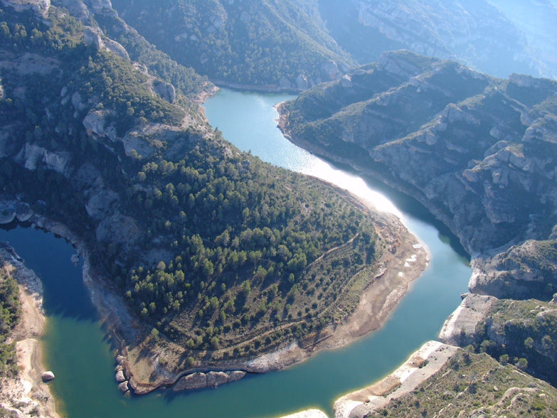
The path back through the Barranc dels Colls Baixos |8.4| is easy to follow. After a short while, the path becomes a track that leads all the way to the Montsant river |8.5|. When the route might be doubtful, there are signposts. When you reach the river, you can either return to the village by crossing the river and passing the football field, or continue as far as the swimming pool bridge by the track, which follows the river to the left.
Image gallery